Mojave National Preserve Drive-Thru
I traveled with my mom to the Mojave National Preserve for a quick day-trip loop of the park on February 5th, 2020. Although this preserve is immense, I was able to see enough to know I’d like to return for some camping and hiking with family and friends. Let me share our route with you!
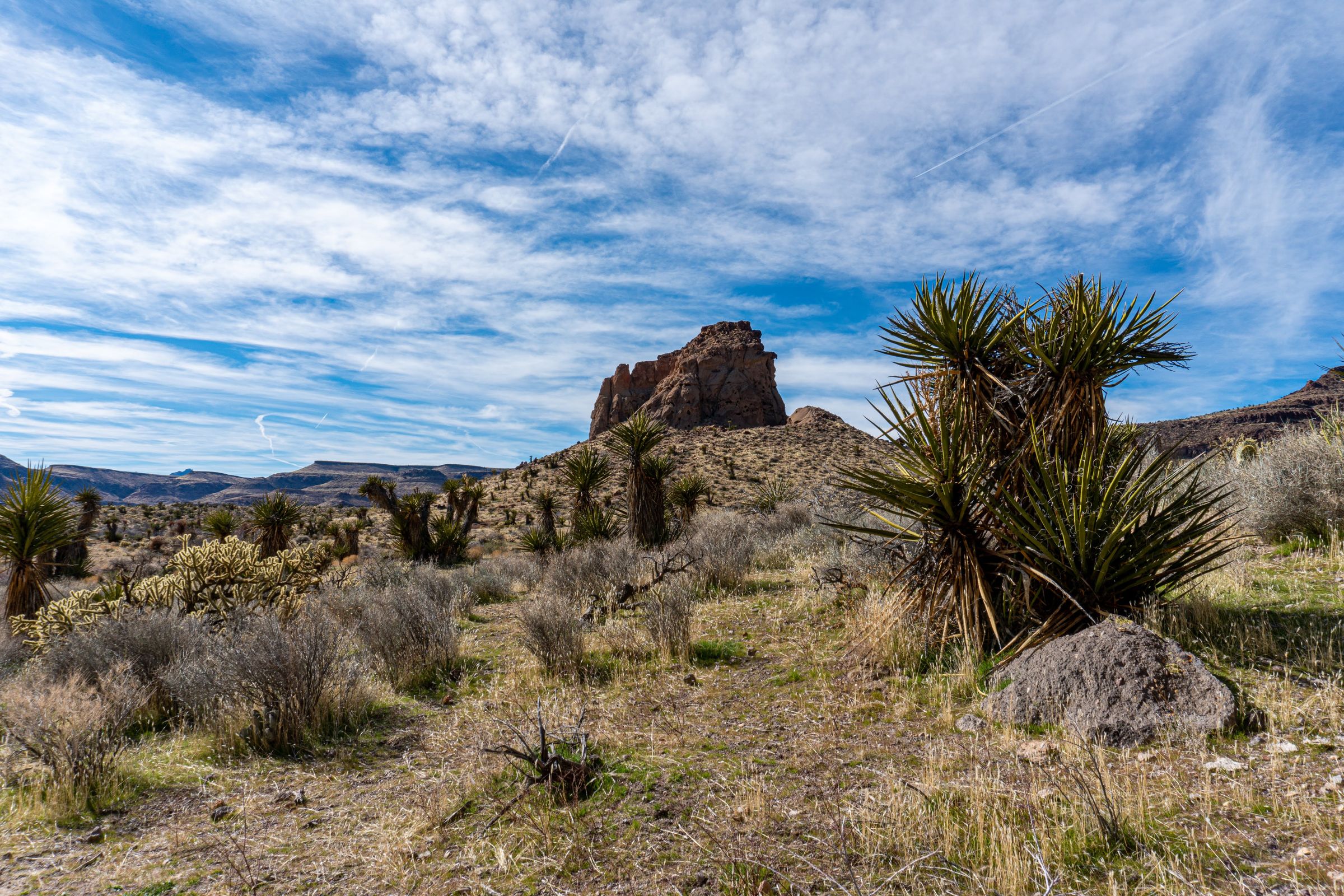
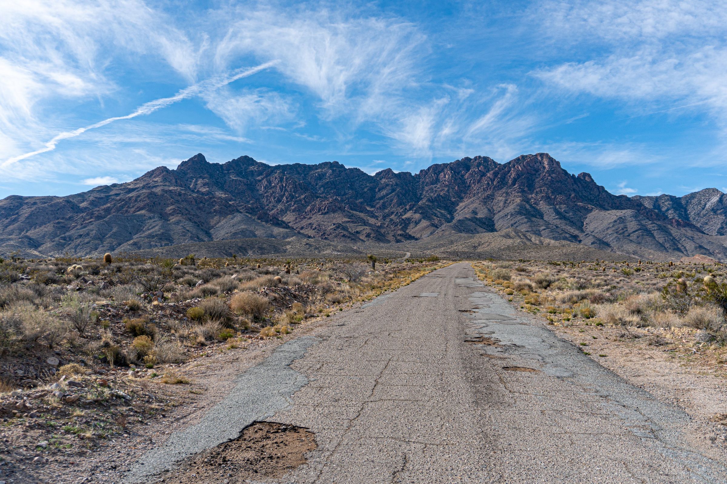
We entered the park at Kelbaker road off of I-40 on the south side of the park. This entry seems to be at a fairly high elevation and immediately climbs into some classic high desert Mojave landscapes. You see a lot of the granite along with yuccas that you see above 3000-4000 feet through the desert. The rocks are reminiscent of what you see throughout the Mojave side of Joshua Tree NP, Sawtooth off of highway 247, or Horsemen’s Center in Apple Valley, but with a quantity of a type of yucca you won’t see in those places.


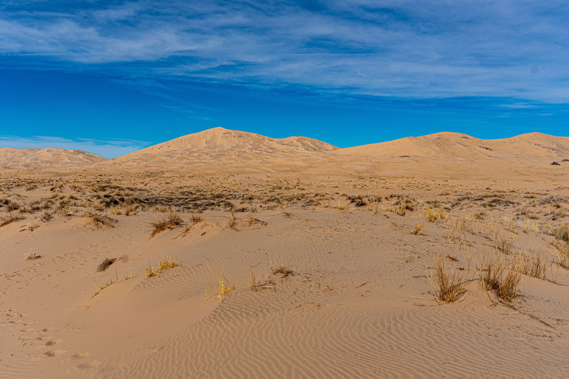
Continuing north, Kelbaker road descends. The large Kelso dunes with their prominent peak appear. This largest peak ascends about 650 feet above its surroundings. Looking east from the trail head, you can see the back side of the providence mountains, which is a state park inside of the National Preserve’s limits.


We then proceeded to the town of Kelso where there’s a rail station and some NPS buildings. Unfortunately, we didn’t have time to stop and check out the stop, but I’m sure it’s worth a stop for anyone not taking a quick loop. I just tend to prefer driving, though I’d probably learn more if I stopped at these places more (it turns out the internet often doesn’t have all the info).
From Kelso, we turned northeast up Kelso-Cima Road into higher country. Shorter yuccas begin to emerge, followed by an impressive quantity of Joshua Trees as you get to Cima (which was perhaps a historical town or something, but doesn’t have much more than a ranch or two anymore as far as I can tell).

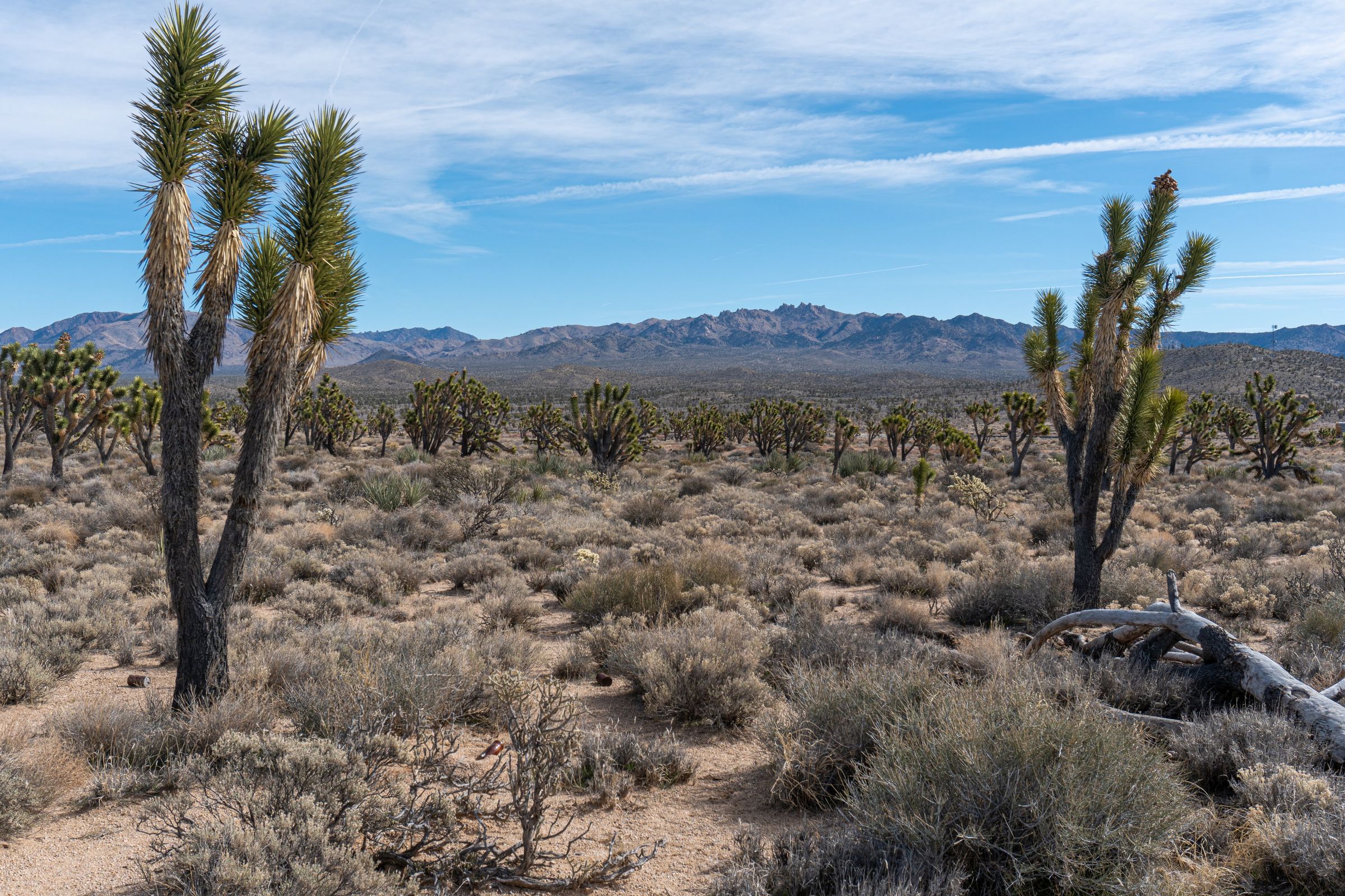
We took Cima Road as far as the Teutonia Peak trail. This is a trail I’d like to come back to and hike. The trail is at about 5000 feet, and there are about as many, if not more, Joshua Trees than you’ll see anywhere in the Mojave (I’m from Apple Valley, so I’ve seen some Mojave Desert). The trail is close enough to I-15 that you could probably hike it quickly if you need to stretch your legs on the way to Las Vegas. The elevation is high enough that you could probably hike it in summer as long as you bring water and sun protection.
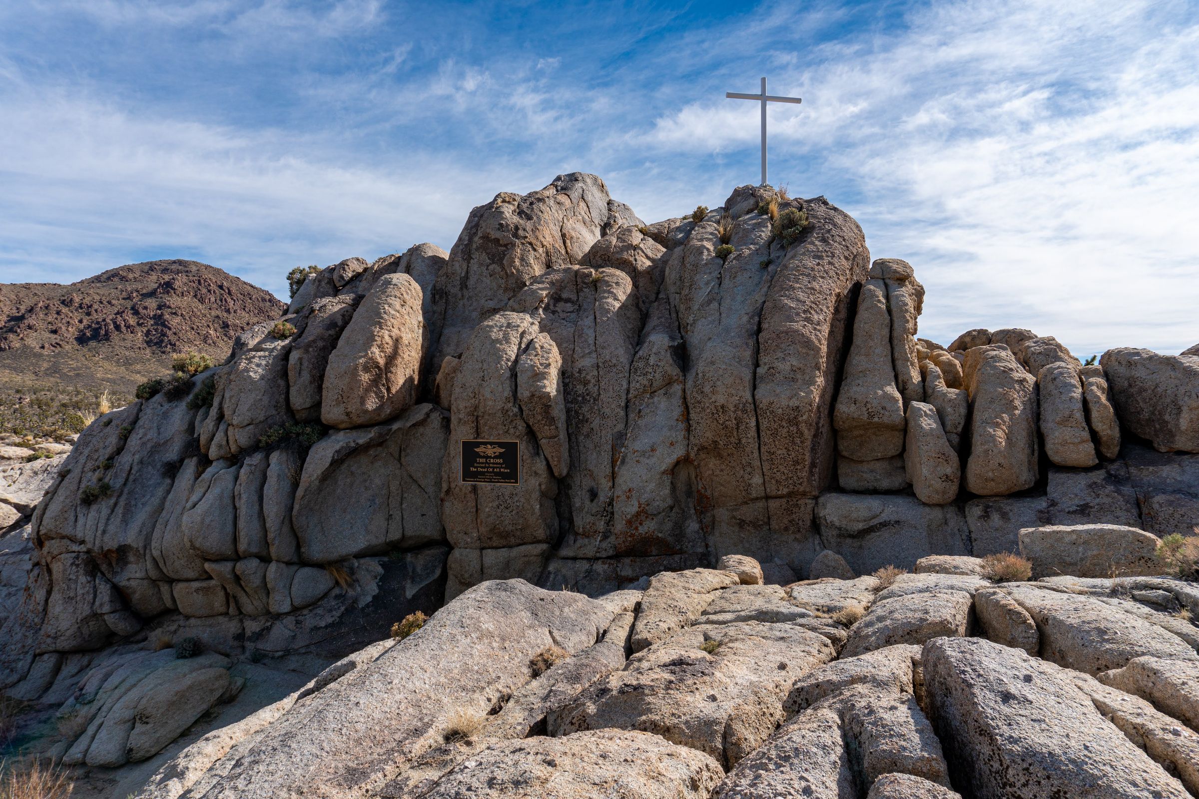
Near the Teutonia Peak Trail is the Mojave Cross, a WWI memorial that was at one time controversial. Being a resident of the conservative high desert, the controversy of a cross on public land was often a rallying cry against an encroaching secular world. The cross and monument’s status was eventually taken to the US Supreme Court, which allowed the cross to stay (though according to the Wikipedia source, they sent the case back to a lower court and the issue is not resolved).


We then headed back in the direction we came from down Cima and Kelso-Cima Roads, turning east onto Cedar Canyon Road. This road is unpaved, but shouldn’t present a problem for any car with reasonable clearance (barring muddy conditions). We headed through the canyon en route to the Mid Hills Campground, which I was eager to check out as a potential site to take family camping some day.


After passing through the canyon, we turned right on Black Canyon Road (paved), then right on Wild Horse Canyon Road (paved up to the campground) to the Mid Hills Campground. While this path climbs to higher elevation (which typically means fantastic desert), you begin to see how fire has ravaged the junipers. Evidently, these landscapes are not like mountain forests that thrive after fire, and it appears the junipers are not going to return any time soon, if ever. Some yuccas are emerging, but it’s still a bleak scene. I’ve included the blog below about the likely culprit of the vast Juniper destruction in this area. There are some pretty grasses sprouting up in other parts of the park, but I wonder if these are also invasive culprits of the fire.
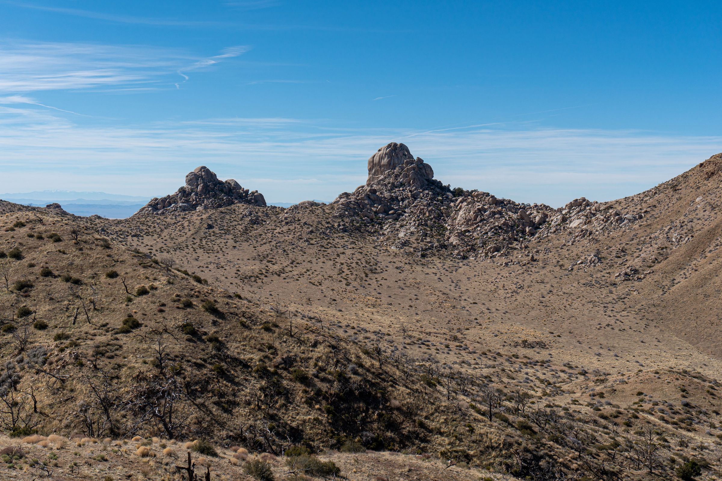
The Mid Hills Campground appears to be near ground-zero of the fire. However, there are still great views from the high elevation along with some living junipers to provide shade toward the back of the campground. If you take a short walk up one of the prominences above the campground, you’ll get a great view of the preserve and surroundings. I could even see as far as the snow-capped Mount Charleston in Nevada.


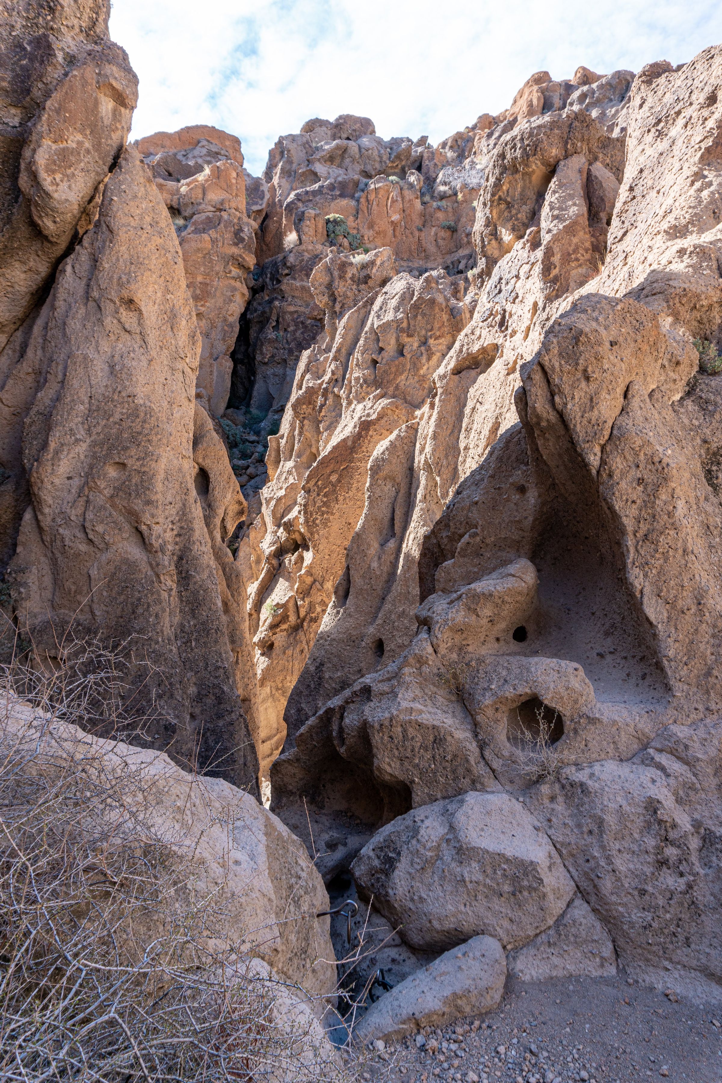
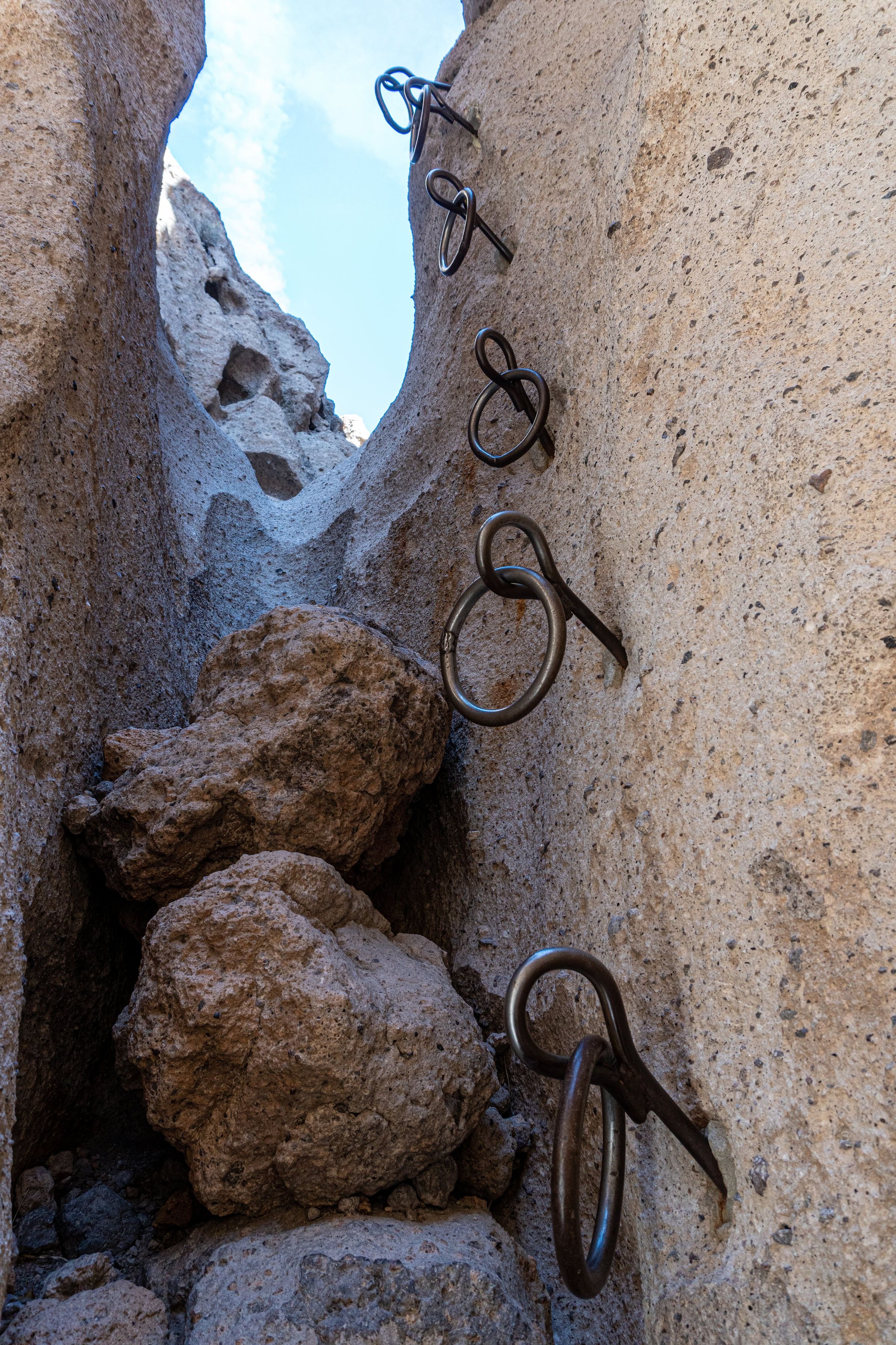
We continued down Black Canyon Road to the Hole-in-the-Wall Visitors Center and Campground. This appears to be the busiest campground in the park with many parked trailers and campers. Near the visitor center is a popular little trail through a narrow canyon (the hole in the wall). The trail features two sets of rings that help you climb up the narrow gaps. I was a little timid climbing down the rings, but in reality it wasn’t too difficult. I am a poor scrambler. If you do the loop in the direction taking the rings up the canyon, you shouldn’t have a problem if you’re in fair condition. Either way, the trail is short (~ 1 mile loop), so if you feel uncomfortable you can turn around. For reference, the rings are just north of the visitor center. So you’ll want to start heading south on the loop to go up the rings (towards Wild Horse Road). Just south of the visitor’s center are some drawings on rocks.


We finished our journey by heading up to Providence Mountains State Park. However, the park was closed on the day of our visit. I would be interested in returning and making reservations to see the caves. We also missed some lava tubes and the Amboy Crater located just outside of the park. There’s always more to see!

I hope you’ve found some useful information and are inspired as I am to return to see some awesome desert.